October 2016
This time I was going to Nepal with some friends. My third trip to the country. The challange was they only had around two weeks. That is really not enough time so I scratched my head for a while, but ended up with a plan of walking part of the oldest teahouse trek in Nepal. I walked a little part of it in 2001. The following describes the trekking days and drive in and out.
About us and the company we used
We where 6 people and we travelled with Firante Treks & Expeditions.
I found the company online and had no previous knowledge about them so I where a little worried, but I wanted to use a local company and since I have been in Nepal several times before and also trekked high before I asked for only one guide and porters. Janga was of great assistance for the upfront organising, we got a great guide (Dawa) and the Rai relatives were the best porters. Everything was arranged as requested and we had a great trip. Just be aware that ATMs in Nepal still is trouble. There are several in Kathmandu, some in Pokhara and a couple in Jomsom, but a lot do not work (empty or something else) and there are usually a limit of 20000 to 30000 rupees on each withdrawal. So make sure you have a agreed on payment method up front.
The accommodation was in tea houses which these days are larger or smaller places with basic rooms and a room where they sell food.
I would suggest to always carry some extra clothes yourselves in case of really bad weather, see the 2014 disaster.
Day 1
Drive from Kathmandu with start very early in the morning for around 5 hour in bus on usual Nepalese roads (not good) to Besisahar. From there road from hell. I have been on a lot of bad roads but this is really bad. But not that scary. Almost not a road, more a pile of rocks. A wonder the cars last (Indian Mahindra). For obvious reasons not high speed. We were 12 people in one jeep, 3 in front, 4 inside in the back and 5 out in the back. The porters and the guides in the back. People in the back are not allowed for security reasons. I should have checked this better up front. The plan was to reach Chame, but I think everyone knew that was not possible. Spent the night in Dharapani between Besisahar and Chame (1,5 to 2 hours drive from Chame).
Day 2
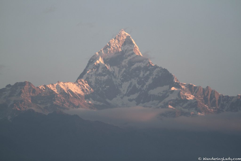
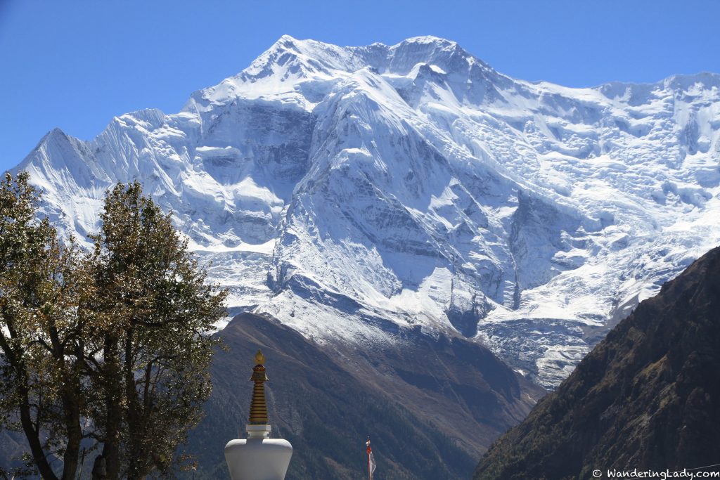
Two more hours in jeep to Chame where we breakfast. Then a nice walk to Pisang (3300 m). Upper Pisang is a little up with nicer view and old buildings. Seems like most tea houses are in Pisang, but would rather have stayed in Upper Pisang for the view of Annapurna 2 (picture).
Day 3
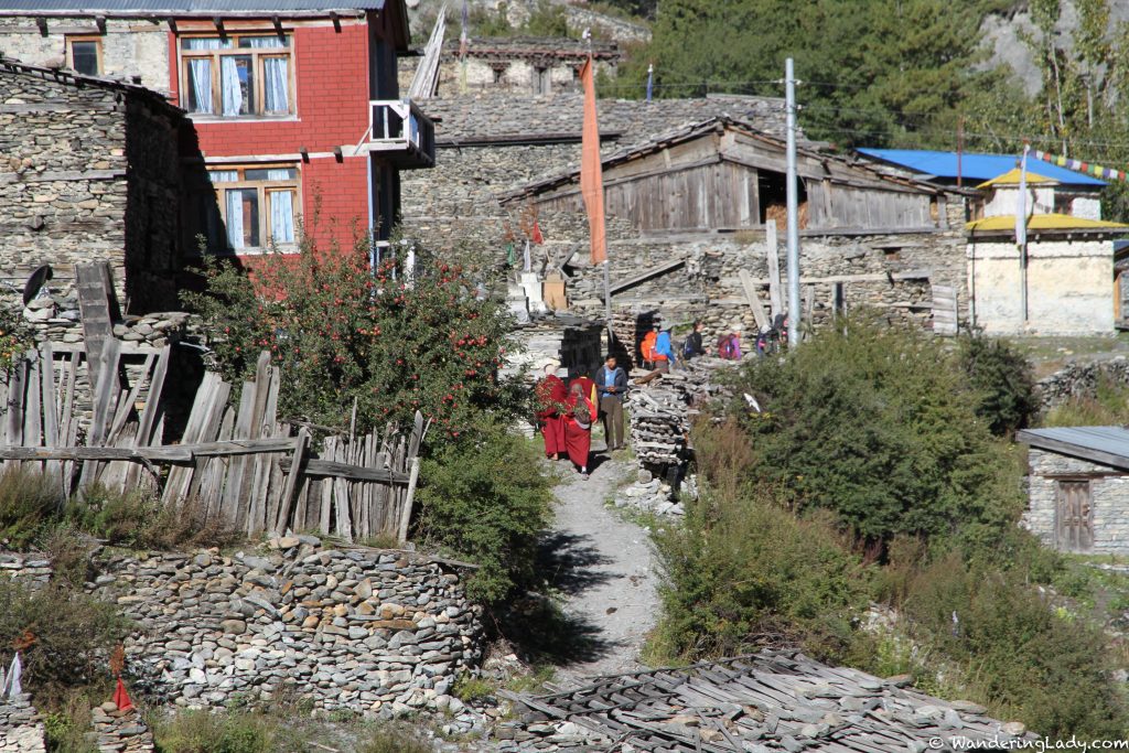
Choose the longest path to Manang (3540 m) for scenery and acclimatisation. The road goes at least as far as to Manang. Four hours walking to Ngawal (3660) which is the first place you come to. Nice and clean place. If I ever walk here again I will stay here one night. Several more hours to Manang. Around eight hours all together and some already felt the altitude.
Day 4
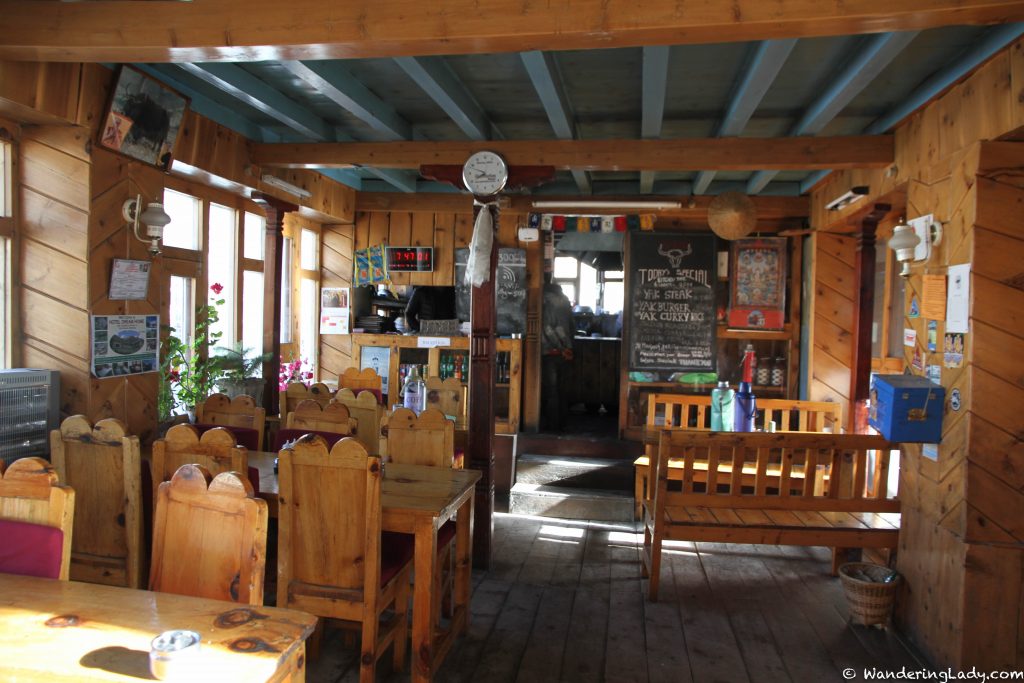
Acclimatisation day in Manang. Not really that happy about the place or where we stay (Yak Hotel). Manang is large compared to other places in the area. Walked to a view point for acclimitation (Ganggapurna). Spent the rest of the day looking at the surroundings and eating. Cake was found 🙂
Day 5
Nice walk to Yak Kharka (4000 m). Steady climb and around a four hour walk. Really nice tea stop in Gunsang, Chuku West Hotel (3990). Really nice place, both the hotel and the view. So if I walk here again I would have skipped Manang and stayed here – if I walked with people with no altitude problems. If someone in the group was having altitude problems I would probably have stayed in Manang one night.
Day 6
Walk to Thorong Phedi (4525 m). Around four hours walk again. At this point a couple in the group had trouble with the altitude. One so much that it worried me; no sleep because of breathing problems and a lot of other symptoms. But not easy to turn back at this point and the guide said go. If you have the appropriate insurance (and make sure you have that) it is realatively easy to get a helicopter to fly you down.
Thorong Phedi is a rather big place (big in the sense that the one place is big), cold and not very nice in my opinion. Cold and plain room so spent the rest of the day in the restaurant area which was filled with a lot of people. I have bin to places on higher altitude which has managed a little better cleanliness (my expectations are not very high).
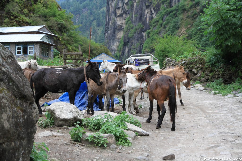
On the path to Thorong Phedi (and up to the pass from Thoriong Phedi) you will find people with horses if you are all out of energy.
Day 7
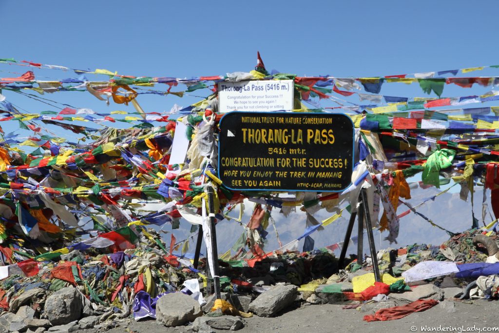
Up to the pass, Thorung La at 5416 m. Started at five o’clock at night in the dark. Had a short tea stop at Thorung High Camp. Very cold and one in the group was quite sick, but it looked like we where going to make it. And we did several hours later. The pass was not one of the most scenic, quite large. But we where very happy that all of us made it.
A long walk to Muktinath after the pass. Ate lunch at Chamber Bhu (4180 m) maybe? A place consisting of mostly restaurants quite a long way down. Before a shower and dinner at hour hotel we stopped at Muktinath Tempel and walked around there for a while. Sort of nice but a lot of people there.
Day 8
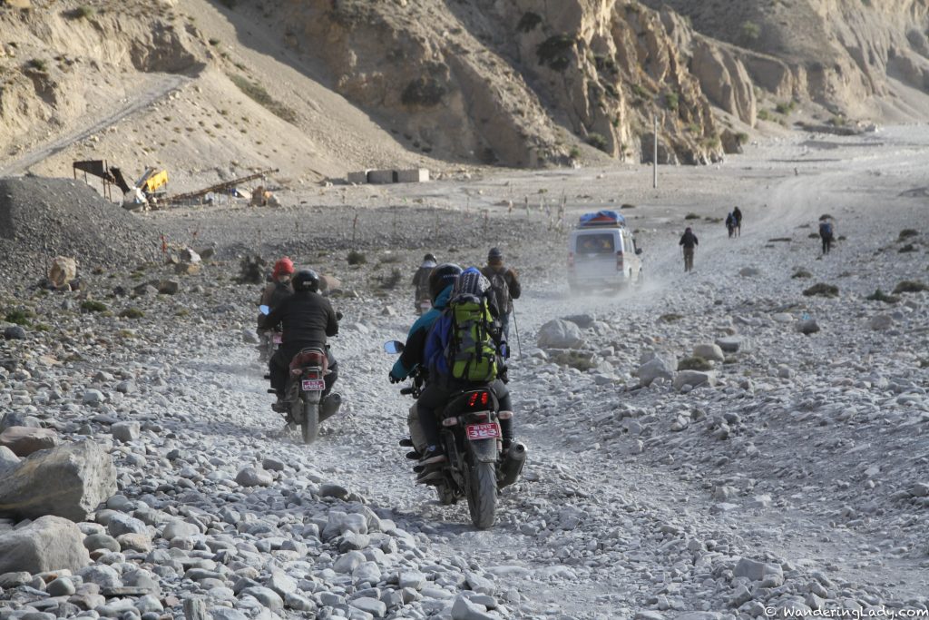
Last walking day. As most of the road to Jomsom is a long quite boring walk in the dried up river (I have walked it before) we took a detour to Kagbeni and planned on trying to catch a bus from there. Yes, there is a road up to Muktinath. Not mush of the circuit is without a road anymore. Maybe the part between Manang and Muktinath.
Nice walk to Kagbeni. Walked through Jharkot. Nice place, we got a little lost in the alleys. Kagbeni seems to have developed quite a bit since I was here in 2001. Walked through the old part I remember to the gate to Mustang. A rather modern coffee shop there now. Not the old prayer wheels I remember, new payer wheels in place.
Ate lunch in Kagbeni. It seems to have grown but looks quite deserted really. Just a couple of restaurants looks open. No luck with the busses so we ended up walking most of the way to Jomsom in the dry, windy riverbed. The guide managed to find someone we could hitchhike the last part with.
Jomsom also seems a lot bigger than last time. We stayed in a ok place and had a nice last meal with the porters. They was going on the bus home (or to Pokhara) the next morning. And then the two brothers where going to Kuwait to work there for four years. So a hard life.
Day 9
Flight to Pokhara where we where going to stay a couple of days. The runway in Jomson is one of the interesting ones and not that cool for people afraid to fly (one in the group was), but not as bad as Lukla (for the Everest base camp trek) 🙂